Comprehensive information on regional coastal processes is now available online following the launch of an environmental observatory by a Masdar Institute of Science and Technology team led by Dr. Marouane Temimi, Associate Professor, Water and Environmental Engineering program.
The portal offers valuable information on the state of the Arabian Gulf including sea currents, temperature, salinity, and other seawater quality parameters related to oil spills and toxic algae blooms that are useful for several applications.
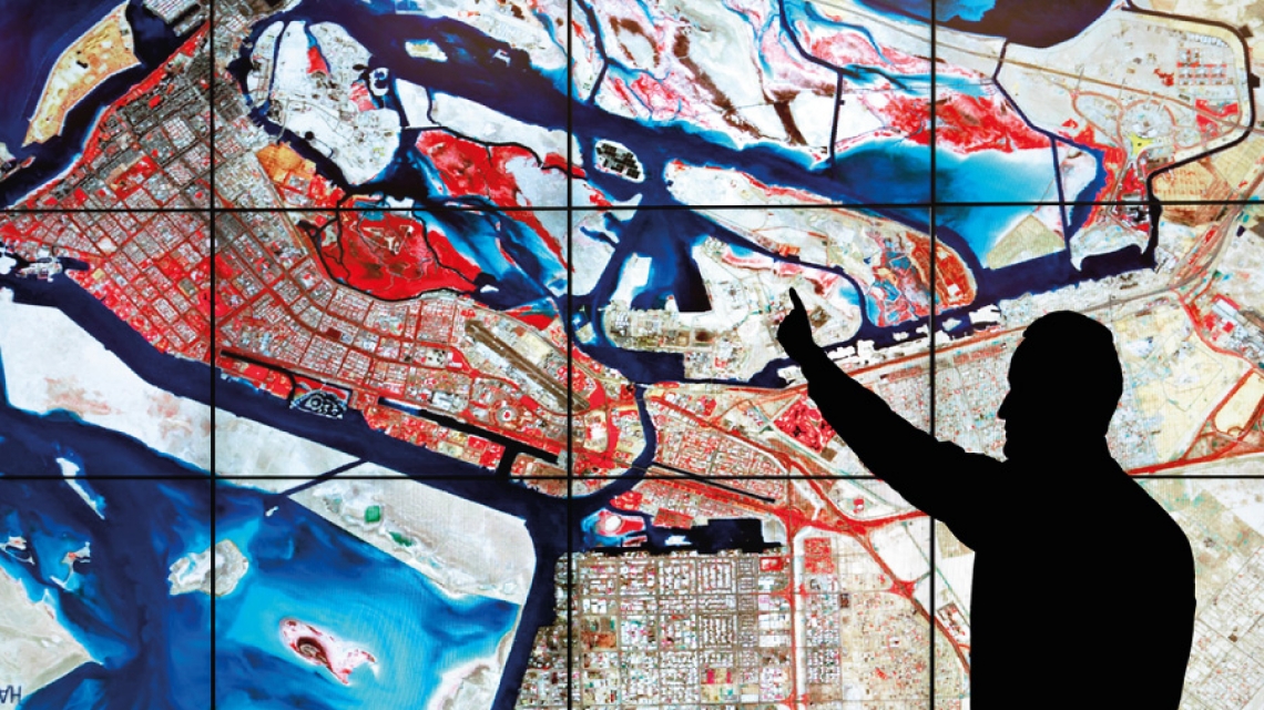
Dr. Temimi said, “The environmental data portal provides information on oil spills, red tides, sea circulation, salinity, and temperature. We have included an example of an oil spill to showcase our capability to track and predict the trajectories of not only coastal hazards like oil spills, and red tides but also dust storms, and flooding, using satellite imagery and modeling. We believe this data portal is set to become the first destination of several end-users like government agencies, desalination plant operators, oil companies, ports, and others who are interested in monitoring environmental processes in the UAE and the region.”
Users of the website can obtain in-depth information including five-day forecasts for the Arabian Gulf with hourly updates. The portal is publicly accessible but registered users will have access to advanced functionalities. In addition, it includes some of the most recent satellite images of the region, and can provide information on oil spills, red tide events, weather conditions from remote sensing images, ‘in situ’ observations, or advanced numerical models. The information will be immensely helpful to several stakeholders, who require such information on a regular basis in the government and private sector.
The use of remote sensing technologies and models, along with in situ observations, provides users with a comprehensive overview of the state of the Arabian Gulf and on potential hazards that could threaten coastal infrastructure and activities, like fishing, desalination and tourism.
“The role of remote sensing is crucial in the region as it gives us, with frequent refresh, a synoptic view of the conditions in the Arabian Gulf and complements information derived from models,” explained Dr. Jun Zhao, a research scientist and remote sensing expert involved in the portal.
Dr. Temimi and his team members in the Environmental Remote Sensing and Modeling Lab at Masdar Institute have several environmental monitoring collaborations. They received funding from United States Agency for International Development (USAID) through a joint project with the Middle East Desalination Research Center (MEDRC) and the US-based Woods Hole Oceanographic Institute (WHOI) to assist desalination plants operators in the region that face red tide events to enhance their operational planning.
The partnership covers monitoring of sea water conditions through the detection and tracking of red tides as well as the collection of sea water samples for comprehensive characterization. Through a series of field campaigns in the Arabian Gulf, the Masdar Institute’s team was able to build a unique library of marine species, which is are important for the study of the region’s marine ecosystem.
Masdar Institute class of 2015 graduate Sheikha Al Kitbi had made satellite-based detection of red tides in the Arabian Gulf a key focus of her thesis research and has co-authored a scientific publication on the project that is currently under review.
Clarence Michael
News Writer
20 September 2015