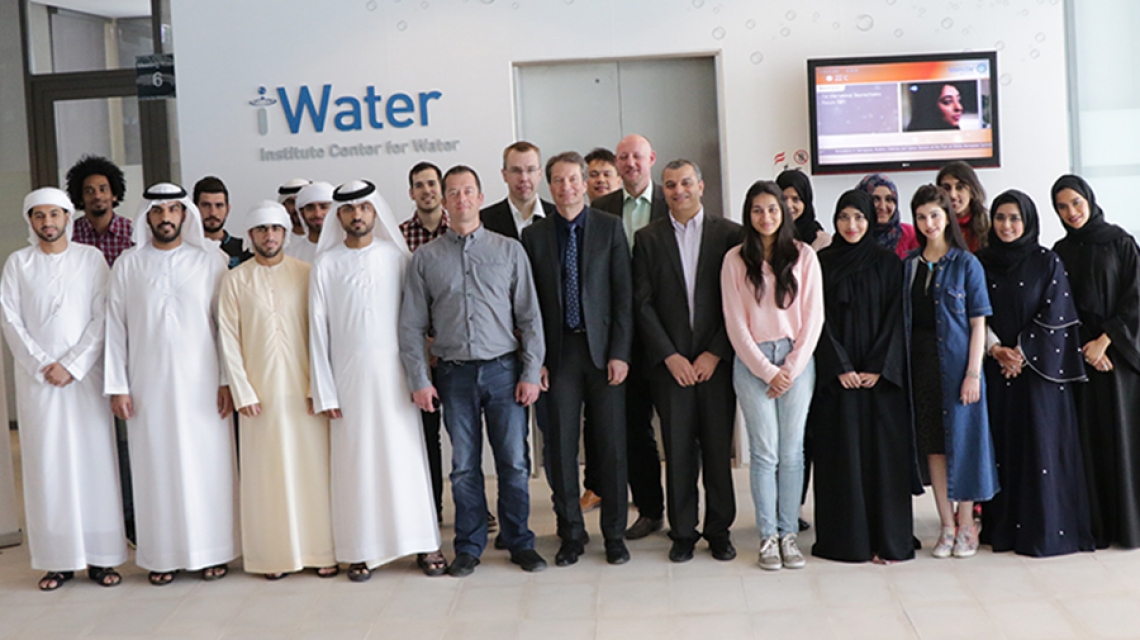
Visiting German faculty contributed to a comprehensive course on satellite remote sensing techniques and geographic information systems (GIS) tools hosted at Masdar Institute for members of the Young Future Energy Leaders program.
The Remote Sensing and GIS Workshop for YFEL members was led by Masdar Institute faculty, with a brief guest lecture by Dr. Volker Wulfmeyer, Professor, Managing Director and Chair of Physics and Meteorology at the Institute of Physics and Meteorology of the University of Hohenheim in Stuttgart, Germany.
Dr. Wulfmeyer, and his team of remote sensing experts contributed to the first module of the workshop, which was focused on remote sensing applications for mapping and monitoring the natural environment. His cloud seeding research project was one of three to receive the UAE Research Program for Rain Enhancement Science Award. His grant-winning project aims to leverage advanced remote sensing technologies to identify optimal cloud seeding deployment regions.
Zainab Al Ali, Program Manager, YFEL, said: “The course is part of our capacity building efforts to train talented youth and students in niche areas such as satellite remote sensing and GIS. It is a key component of our annual schedule of courses designed to help YFEL members develop their ability to solve some of the world’s greatest sustainability challenges.”
The overall course was led by Masdar Institute’s Dr. Prashanth Marpu, Assistant Professor of Water and Environmental Engineering, Dr. Marouane Temimi, Associate Professor of Water and Environmental Engineering, and Dr. Jun Zhao, Post-Doctoral Researcher. Its objective was to equip YFEL members with the skills and frameworks required for implementing sustainable innovation projects and building the UAE’s capacity for continuous innovation.
The two-day course gave YFEL members hands-on experience in satellite data analysis, digital image processing, and generation of maps and manipulation of layers of spatial information. It focused on increasing participant’s understanding spectral and radiometric characteristics of remote sensing platforms and data as well as the specific remote sensing techniques suitable to their research requirements.
YFEL member Hamda Lootah, an employee with the UAE Ministry of Climate Change and Environment, said: “The course in remote sensing and satellite monitoring helped me in understanding the UAE’s environment issues and how some applications can help in tackling challenges posed by changes in weather conditions.”
Another YFEL member Aliaa Alzaabi, an employee with Abu Dhabi Gas Industries (GASCO), a subsidiary of the Abu Dhabi National Oil Company (ADNOC), found the course’s experiment portion, involving measuring the spectrum of different objects at Masdar City, both interesting and useful.
Alzaabi said: “As an electrical engineer I deal with remote sensing in the oil sector but not for the purpose of GIS and weather, so this workshop helped me learn about other applications in remote sensing.”
YFEL member Ali Alhajeri said: “The most important topic that attracted my attention was the use of satellites to detect the location of offshore oil spills. Since I work in the oil and gas industry, I am sure the techniques I learnt at the course will help me in my workplace.”
Every year, the YFEL program offers intensive courses covering technology, policy and leadership that are taught by expert faculty, in addition to lectures delivered by renowned guest speakers.
Clarence Michaels
News Writer
17 April 2016