Members of this theme focus on the outer space environment and how solar wind interacts with bodies in the solar system, particularly planets that have an active and strong magnetic field. In addition, our members are also active in the orbital dynamics and trajectory design for space missions and future concepts. Below are examples of work we are currently focused on
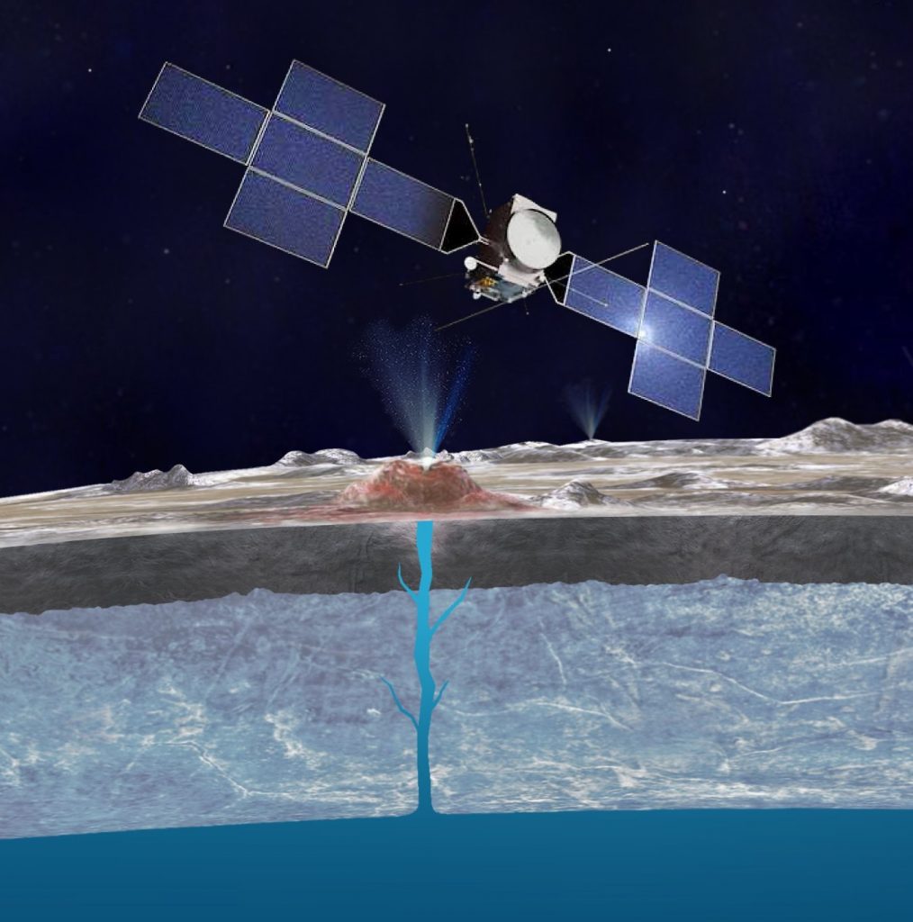
Simulating particle motion at Jupiter’s moons and other planetary objects (Lead: Hans Huybrighs)
The goal of the project is to help answer fundamental questions in planetary science and space physics, such as: how do Jupiter’s moons, particularly Europa interact with the magnetosphere? For this we carry out simulations of the motion of particles (ions, neutrals, dust) near Jupiter’s moons and other planetary objects. These simulations allow the interpretation of data from spacecraft such as NASA’s Galileo mission and will be used to prepare the future observations by space missions such as ESA’s JUpiter ICy moon Explorer (JUICE).
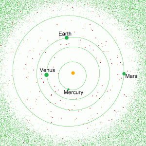
Design of exploration trajectories to Near Earth Objects leveraging low-energy structures in the Sun-Earth-Moon multi-body system (Lead: Elena Fantino)
A Near Earth Object (NEO) is any small Solar System body (asteroid, comet, meteoroid) whose orbit has a perihelion lower than 1.3 astronomical units (AU), hence leading to proximity with Earth. There are over 25000 known near-Earth asteroids (NEAs) and more than a hundred listed short-period near-Earth comets (NECs). The in-situ exploration of these objects plays a key role in our understanding of the origin and evolution of the solar system. In recent years, NEOs have gained importance also in the context resource utilization. We are employing the invariant structures of the circular restricted three-body problem (CR3BP) in which the primaries are the Sun and the Earth-Moon system, for the design of trajectories to flyby and rendezvous with the most interesting and convenient NEOs.
Members of this theme focus on planetary surfaces including the studies of landforms, associated processes, and seasonal and long-term evolution, as well the geologic history. Our work encompasses various bodies including Mars, the Moon, and even comets!
Our members are involved in numerous missions and space instruments including The Emirates Lunar Mission (https://en.wikipedia.org/wiki/Emirates_Lunar_Mission), the HiRISE camera onboard NASA’ Mars Reconnaissance Orbiter (https://hirise.lpl.arizona.edu), the CaSSIS camera onboard ESA’s ExoMars Trace Gas Orbiter (https://www.cassis.unibe.ch), and ESA’s Comet Interceptor Mission (https://www.cometinterceptor.space). Below are a few of the projects our members are currently working on.
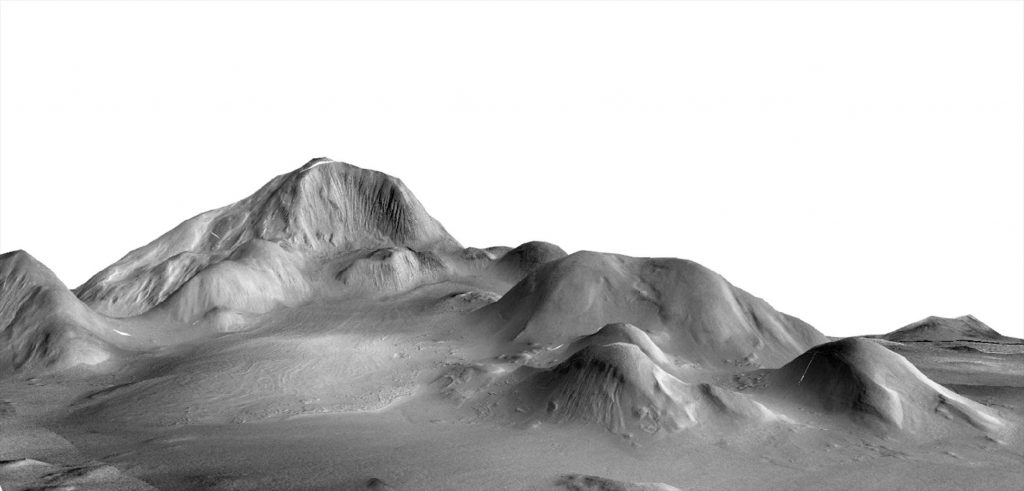
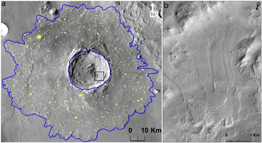
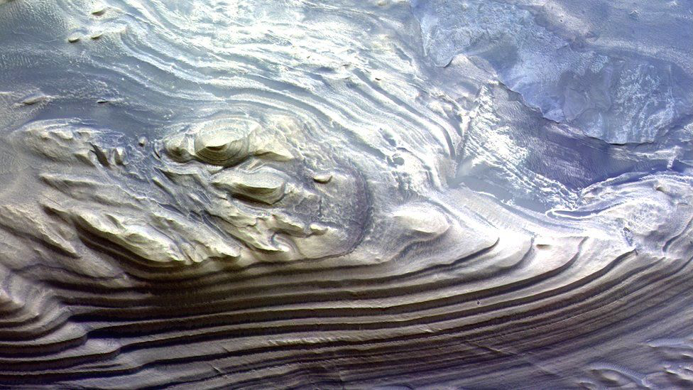
Glacier-like landforms on Mars (Lead: Mohamed Ramy El-Maarry)
Glacier-like landforms (GLFs) and other classes of viscous flow features record the conditions when the obliquity of Mars allowed for the atmospheric deposition of ice in the mid-latitudes of Mars. However, they persist to this day because they are covered by a substantial dust cover that protects them from intense sublimation. While substantial work has been carried out over the years to better understand and characterize GLFs, their geologic settings, morphometry, and overall morphology, we still need to better understand how GLFs evolve with time and what are the geologic or climatic controls on that evolution.
We are currently carrying out a comparative analysis between two notable GLF systems on opposite hemispheres: a notable mountain glacier system in eastern Argyre, and the central peak of Moreux crater that straddles the dichotomy boundary, and has received considerable attention given its inferred long-term glacial evolution, and potential polyphase glacial and periglacial features. Both systems are somewhat similar in terms of geologic setting (flows and features associated with a centralized high ground), overall scale, and apparently young age (100s of millions of years old), so a comparison of these two systems may yield new insights into how such systems evolve with time.
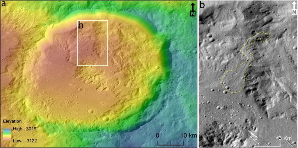
Geological evolution of Floor-Fractured Crater Posidonius on the Moon (Lead: Shreekumari “Shree” Patel)
Posidonius crater is a 95 km diameter located on the north-eastern edge of Mare Serenitatis on the Moon Our focus is to investigate how the present crater has taken its shape, and whether the mineralogy of Posidonius is related to the Mare Serenitatis on the west or the highland region in the south-east. This could help shed new light on the Posidonius crater’s modification stages.

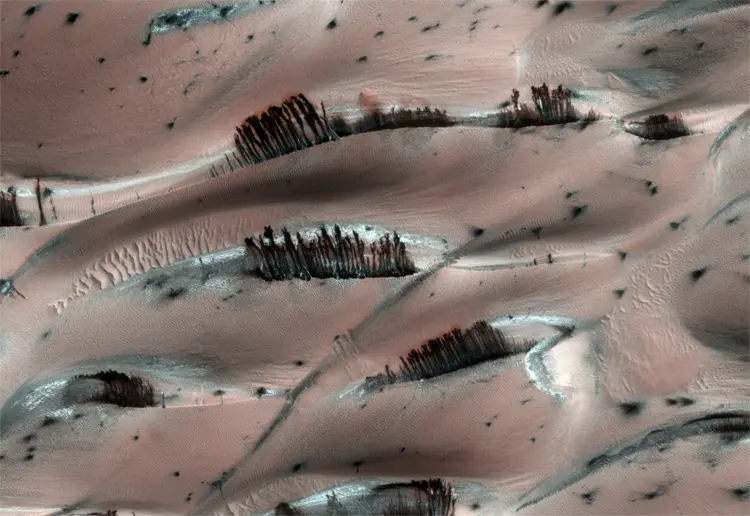
Fate of water on Mars (Lead: Harish)
Sedimentary deposits on Mars retain the records of ancient environments and prevailing climatic conditions. Their origin remains debated among several hypotheses: snowmelt versus rainfall; transient or stable climatic conditions; the role of impact or volcanic activity in melting water ice. Thus, finding key locations to better understand these processes is important to provide answers for their origin. In one of the ongoing projects, we are focusing on the inverted channels on Mars to understand the fluvial activity and prevailing climatic conditions on Mars.
Volatiles on Ceres (Lead: Harish)
The only dwarf planet in the inner solar system, Ceres, is the largest planetary body in the asteroid belt. Previous studies postulated to have ice-rich deposits mixed with regolith on Ceres few centimeters to meters below. Currently, I’m working to identify volatile-rich morphologies within the impact craters on Ceres.
Characterisation of impact melt deposits and a dark ring around Lunar crater using remote sensing data (Lead: Shreekumari “Shree” Patel)
The distribution of impact melt in lunar craters is well preserved and can be studied by remote sensing. Dark rings, which surround large Copernican-age craters, have been observed by Earth-based and satellite data. It should be noted that these halos are not to be confused with small volcanic craters having dark pyroclastic halos nor with impact craters that simply excavate material from an underlying darker layer. Our work can provide new information by combining surface composition information from hyperspectral/multispectral data and sub-surface information and roughness behaviour from microwave data which could give a complete picture of the geology of the study areas. In addition, it will provide a base to understand the non-volcanic dark halos impact-related processes, the longevity of the halos in the face of ongoing bombardment of impactors of various sizes, and whether they can provide clues for inferring the relative ages of impact craters.
Members of this theme focus on planetary atmospheres. Numerous planets other than Earth hold and maintain an active atmosphere such as Mars and Venus, and there is even a moon, Titan (One of the moons of Saturn) that has think atmosphere and complex organic geochemistry beyond what we are used to here on Earth!
Our members are active in the modeling and data analysis of the Emirates Hope mission. Below, are a number of projects we are currently doing.
Investigation of the Oxygen Corona and Photochemical Escape at Mars (Lead: Krishnaprasad Chirakil)
The exosphere or corona is the region of atmosphere where collisions between atoms and molecules are infrequent due to their low densities, and the particle trajectories are predominantly ballistic in nature. The corona of Mars mostly consists of atomic hydrogen and atomic oxygen. The “hot” atomic oxygen in the Martian corona is primarily produced by the dissociative recombination of oxygen ions. One of the important atmospheric loss mechanisms from Mars at the current epoch is the non-thermal escape of atomic oxygen to space. The Emirates Mars Ultraviolet Spectrometer (EMUS) is one of three remote sensing instruments on board the Emirates Mars Mission (EMM) Hope spacecraft. EMUS is a high-sensitivity UV spectrometer with a spectral range of 100–170 nm. In the corona, the FUV solar resonant fluorescence emission line of atomic oxygen at 130.4 nm is observed by EMUS. We are comparing the EMM/EMUS oxygen corona observations up to 6 Mars radius (RM ) with a three-dimensional particle transport model that calculates the collisional transport and escape rates of hot oxygen to better interpret the data from the Hope mission.
The diurnal and seasonal variation of water ice clouds on Mars (Leads: Samuel Atwood and Anton Fernando)
A considerable record of Martian water ice cloud observations has now been produced from the combined measurements of numerous Mars missions. However, much of this record is derived from sun-synchronous spacecraft that observe at roughly the same local time across their domain (typically early afternoon) or surface instruments with no spatial coverage beyond the lander location. Where local time variable observations of water ice cloud exist, spatial, temporal, or seasonal coverage is often limited. Such bounds to observational coverage hinder efforts to develop Mars atmospheric climatologies, validate global circulation models, and resolve observational anomalies.
The Emirates Mars Infrared Spectrometer (EMIRS)—a thermal-infrared spectrometer onboard the Emirates Mars Mission (EMM) spacecraft capable of retrieving water ice cloud column optical depths—observes across all local times and a wide range of latitudes and longitudes, yielding broad coverage at relatively short timescales on the order of two weeks.
We investigate EMIRS water ice cloud optical depth retrievals focused on diurnal variability. Additionally, we compare EMIRS observations against modeled water ice cloud abundances from the Laboratoire de Météorologie Dynamique (LMD) global circulation model (GCM), to better understand the drivers of diurnal variability in a number of location on Mars, including in association with high volcanoes.
In another approach, water ice optical depths provided by Mars Color Imager (MARCI) of Mars Reconnaissance Orbiter (MRO) and Emirates eXploration Imager (EXI) of Emirates Mars Mission (EMM) are being used to investigate seasonal and diurnal variations of the clouds in four volcanic regions: Alba Patera, Olympus Mons, Tharsis region and Elysium Mons. The observed seasonal and diurnal variations of water ice clouds over volcanic regions are not well understood, and thus context will be provided using the meteorological fields from global circulation models.
Atomic Hydrogen distribution and its variability in the Martian corona (Lead: Raghuram Susarla)
The study of atomic hydrogen distribution and its loss rate from the Martian atmosphere can help us to understand the history of water presence on Mars. Previous observations have shown that atomic hydrogen density is highly variable in the Martian exosphere but its spatial and temporal variability over a large period is not yet well-understood. Characterizing the hydrogen variability in the Martian exosphere is one of the primary goals of the Emirates Ultraviolet Spectrometer (EMUS) onboard Emirates Mars Mission (EMM). A global hydrogen distribution model for atomic hydrogen is essential while retrieving the density and temperature of hydrogen from the EMUS/EMM observations. We are developing a 3-D hydro-gen distribution model, which along with the EMUS/EMM observations, will be used to constrain the density and temperature of hydrogen in the Martian exosphere. This model can also be used to retrieve other important parameters, which allows us to study the global distribution of atomic hydrogen and its variability at different Martian seasons and also under different space weather conditions.
Involvement in ongoing and future national and international space missions is at the core of our activities at the SPSC. Our members aim to be involved in various ways including data analysis, operations, planning of observations and measurements, and data archiving. Below is a list of missions or instruments our members are currently involved in, which span a wide range of bodies in our solar system!
Emirates Mars Hope Mission
Emirates Lunar Mission
CaSSIS, onboard ESA’s ExoMars Trace Gas Orbiter
HiRISE, onboard NASA’s Mars Reconnaissance Orbiter
Comet Interceptor (European Space Agency “ESA”)
ESA’s ExoMars Rover (Rosalind Franklin)
The Emirates Hope Mission (2021-)
Mission website: https://www.emiratesmarsmission.ae
The Emirates mission is UAE’s first space exploration mission and the first Arab mission to Mars. It launched in 19 July, 2020, and arrived at Mars in early 2021, where it has been conducting scientific investigations of the Martian atmosphere ever since. The mission carries a suite of instruments with the objective of studying the entire atmosphere.
Our members are directly involved in the data analysis of the mission.
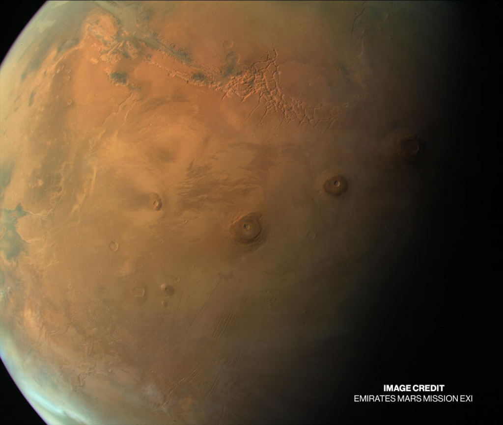
An observation of Mars by the EXI instrument showing vast regions on the Martian surface including giant volcanoes (at the center of the image), and the massive valley system Vallis Marineris (in the upper left). Ice and frost can also be seen near the polar regions at the bottom right. (credit: MBRSC)
The Emirates Lunar Mission (To launch in 2022)
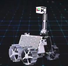
The Emirates Lunar mission is the next step in the UAE’s ambitious space exploration program as the UAE plans to send a rover (called “Rashid) to the Moon. The mission is expected to launch in October 2022 where the rover would be delivered by a Japanese lander. The planned landing site is in the Lacus Somniorum (“Lake of dreams”) region close to the Lunar Equator. The rover is planned to be equipped with high resolution visible cameras, thermal cameras, and a Langmuir probe to study the lunar dust and plasma. Our members would be involved with mission operations, data analysis, and eventual archiving of the mission data.
Colour and Stereo Surface Imaging System “CaSSIS” (2016- )
Mission: ExoMars Trace Gas Orbiter
Instrument website: https://www.cassis.unibe.ch
The European Trace Gas Orbiter includes the CaSSIS camera, which is a high resolution multi band camera that takes color and stereo observations of the Martian surface at a resolution of less than 5 meters per pixel. CaSSIS is designed in a unique setup and includes a rotation mechanism that allows the camera to take an image of the surface, rotate 180 degrees, and then take another image of the same area from slightly different viewing angle, which allows it to construct high quality stereo observations that allow us to view the surface in 3D, and in color! Our members are involved in data analysis and occasionally planning of imaging operations!
High Resolution Imaging Science Experiment “HiRISE” (2007- )
Mission: Mars Reconnaissance Orbiter
Instrument website: https://hirise.lpl.arizona.edu
NASA’s MRO mission has been in orbit around Mars since 2007. One of the instruments it has onboard is the HiRISE camera, which is the highest resolution camera ever flown to Mars. HiRISE is able to acquire high resolution images of the surface at a resolution of less than half a meter per pixel, and can generate images as high as 0.25 meters/pixel. This allows us to study the Martian surface and seasonal processes in very high detail. Because of its high resolution, HiRISE has also been used on numerous occasions to characterize potential and eventual landing sites for numerous NASA and ESA rover and lander missions. Our members are involved in data analysis and occasionally planning of imaging operations!
Comer Interceptor (Launch: 2029)
Mission website: https://www.cometinterceptor.space
The Comet Interceptor mission is an ambitious future mission operated by the European Space Agency (ESA) in partnership with the Japanese Space Agency (JAXA) to send a spacecraft and two additional probes to investigate a long-period comet, preferentially a dynamically-new one, or an interstellar object. The mission would launch along with another mission called ARIEL and would reach its “parking” destination in the L2 Earth-Moon Lagrange point, where the spacecraft would wait for the discovery of a long-period comet or a dynamically new comet entering the solar system for the first time. Once a discovery is made, the target’s orbital elements have been defined accurately, and a feasible trajectory has been planned, the spacecraft would be sent to “intercept” the comet and investigate it as a “flyby” mission. Two smaller probes would separate from the main spacecraft shortly before closest approach and head out in different trajectories to make simultaneous measurements and observations of the target from different viewing points, which would allow for a much better characterization of the surface and the surrounding dust and plasma environment. We are currently part of the mission’s science team, and involved in coordinating the nucleus science theme of the mission.
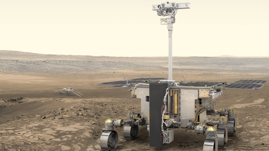
ExoMars Rover “Rosalind Franklin” (Launch: 2022, now delayed)
Panoromic Camera “PanCam”
Instrument website: https://exploration.esa.int/web/mars/-/45103-rover-instruments
The ExoMars “Rosalind Franklin” rover plans to explore the Oxia Planum region on Mars to better understand the ancient climate of Mars, and more importantly, search for signs of current or past life on the red planet. In order to do so, it has a drill that would allow it to drill down to 2 meters below the surface and acquire samples that have not been damaged by surface weathering or intense radiation to look for signs of current or past life. We are involved with the Panoramic camera on the rover, which is the principle scientific camera for the rover and would act as the “eyes” of the mission. The mission was due to launch in 2022. However, it has now been delayed due to political tensions in Europe.