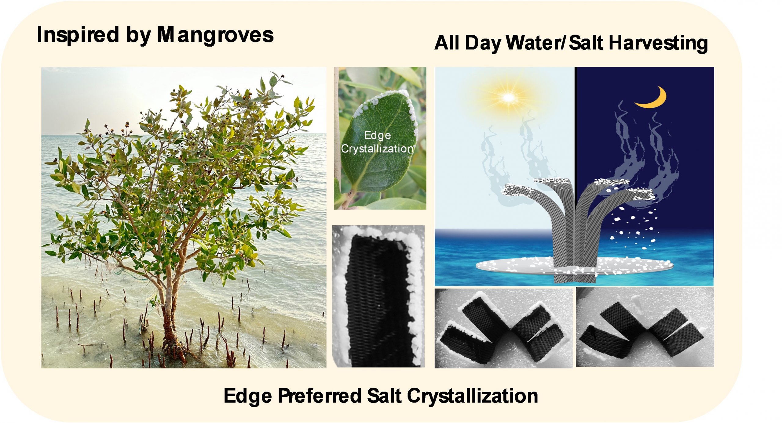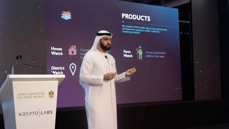
Two Khalifa University startups being incubated by the GeoTech Innovation Program, Farmin and Ayn Astra, delivered business pitches at GeoTech Innovation Program Demo Day on Wednesday, 11 September at Krypto Labs in Masdar City.
The GeoTech Innovation Program is a joint initiative by the UAE Space Agency and Krypto Labs to accelerate the growth of business startups and transform their innovative ideas into commercially viable, scalable, and market-ready products, fostering innovation and knowledge-based activity in the UAE space industry. Many investors and experts in space tech joined GeoTech Innovation Program Demo Day and learned about the smart solutions being developed by KU companies Farmin and Ayn Astra in the field of satellite data processing.
Ayn Astra offers a land deformation monitoring platform that uses satellite data and advanced processing algorithms to map ground deformation patterns. The startup is founded by Adham Alkhaja, PhD student in Aerospace Engineering Department, Dr. Prasanth Marpu, Associate Professor of Electrical Engineering and Computer Science, and two KU alumni Dr. Nikolaos Lisosis and Dr. Prajowal Manandhar.
Ayn Astra uses data from optical and radar satellites, in situ measurements and land cover mapping to deliver continuous ground surface deformation monitoring solutions. This allows customers to efficiently plan and manage infrastructure and housing development projects. The startup aims to expand its operations by providing a wide range of satellite-based services such as monitoring the health of palm trees and tracking the movement of sand dunes.
Farmin is a smart agriculture platform that combines satellite imagery with AI to continuously map entire farm fields to maximize farm production. Founding members include KU’s Dr. Ali AbdulKareem, Assistant Professor of Chemical Engineering, and Dr. ZiAng Zhang from Rice University.
The system analyzes multi-spectral satellite data that measures water levels, soil nutrients and diseases in the ground, and displays where the strong and weak yield spots are located. Then an in-house developed AI technology recommends an action enabling early intervention to be taken. The system helps to maximize farm production, save costs by cutting down on water and fertilizer consumption, and combat climate change by promoting sustainable agriculture.
The GeoTech Innovation Program Demo Day gave Farmin an opportunity to showcase the interface they developed, the working features, the problems it can solve and the numerous potential future applications.
“Farmin can help government oversee and forecast the agricultural production of an entire region, enabling them to strategically plan into the future,” shared Dr. AbdulKareem.
The Demo Day also helped match the startups with potential partners and interested end-users, providing them with an opportunity to seek further funding to complete the development of their satellite-based products.
Ayn Astra is seeking to raise funds in order to acquire and process large amounts of archived satellite data to develop a historical record of deformation over wide swathes of land, including residential, industrial, civil infrastructure and farms. The startup then aims to continuously monitor expansive areas to look for future deformation trends.
Currently, Farmin requires lengthy pre-processing of data and can only do it in very small areas. Additional funding will help increase the scale and efficiency of the unique agriculture tool.
The startups reflect KU’s commitment to bridging the gap between lab and market and bringing innovations most critical to key UAE sectors to market where they will benefit society and further advance the development of the country’s knowledge economy.
Erica Solomon
Senior Editor
01 October 2019