The Masdar Institute Environmental Monitoring Platform (MIEMP) was established in 2015 by Masdar Institute to coordinate and streamline support for research projects related to climate, renewable energy, and the environment.
MIEMP research endeavors to develop tools that can aid decision-making and help UAE adapt to a changing climate. Continuous operation of environmental monitoring stations is critical to this research.
The mission of the MIEMP is to collect, validate, and make available continuous, high-quality historical records of environmental variables in the UAE, including micrometeorological and ground-based remotely sensed data from meteorological LiDAR’s (Light Detection and Ranging).
MIEMP data are crucial to a vast number of scientific disciplines, including climate sciences, meteorology and micro-meteorology, renewable energy resource assessment, hydrology, ecology, agriculture, aerosol science, and air quality studies.
Recognizing the uniqueness of environmental conditions in arid-lands, the MIEMP also promotes efforts to establish standards for data acquisition and calibration-validation procedures in hyper-arid regions.
Over the last five years, the MIEMP has supported a large number of inter-disciplinary research projects at Khalifa University. Active projects include:
2020-2022Through-light-Optimized Agrophotovoltaic Systems for Sustainable Dry-land Agriculture, funded through the Abu Dhabi Department of Education and Knowledge (ADEK) Award for Research Excellence (AARE2019), PI: Annalisa Molini, Co-PI: Matteo Chiesa and Lina F. Yousef.
2019-2022Exploring halophyte hydrodynamics and the role of vegetation traits on ecosystem response to disturbance at the terrestrial-aquatic interface, funded by the US Department of Energy (DOE)/Office of Science Program: Office of Biological and Environmental Research, PI: Ashley Matheny (University of Texas at Austin), Co-PIs: Annalisa Molini (Masdar Institute, UAE), Chonggang Xu (Los Alamos National Laboratory), Matteo Detto (Princeton University), Timothy Shanahan (University of Texas at Austin).
2019-2022Numerical Modelling of Radionuclides Dispersion in the UAE Environment(the “MORAD Project”),funded by the UAE Federal Authority for Nuclear Regulation (2019-2022) PI: Diana Francis, Co-PI Yacine Addad.
2018–2021 Multi-sensor Low-Atmosphere Optical Properties Characterization for Concentrating Solar Technologies Efficiency Assessment in Dusty Hyper-arid Regions, funded by Khalifa University of Science & Technology, Competitive Internal Research Award (CIRA), PI: Annalisa Molini, Co-PIs: Peter Armstrong, Prashanth R. Marpu.
2018-2022Integrating schemes from UAE Rain Enhancement Projects into a unified multi-component atmospheric model, funded by the National Center of Meteorology, PI: Diana Francis.
2018-2020Assessing the Health and Potential for Blue Carbon Storage of the Abu Dhabi Mangrove System through Remote Sensing and Ground Micrometeorological Observations,funded through the Abu Dhabi Department of Education and Knowledge (ADEK) Award for Research Excellence (AARE2017), PI: Annalisa Molini, Co-PI: Prashanth R. Marpu.
2018-2020Sunshape Profiling Irradiometer (SPI), Innovation Grant (US 8981272), PI: Peter Armstrong. Three instruments are in beta test at MIEMP, SRRL-NREL and SRML-UO; retrieval algorithms under development.
2018-2020Suqia Low-cost Efficient Solar Desalination,funded through the Mohammed bin Rashid al Maktoum Water Award in Innovation (US patent pending 62/472,287) PI: Peter Armstrong. Targeting impoverished water-scarce regions, solar humidification-dehumidification process utilizes low-cost perforated cotton fabric as combined solar collector & humidifier that extracts 2X the water flux of traditional glass-covered basin still.
2018-2020Optimal Model-Based Control of District Cooling Plants,funded by Tabreed, PI: Peter Armstrong. Optimal cooling tower fan-speed control implemented in Plant AD-12 to realize 4% annual energy savings at no capital cost, and larger savings when plant RH sensor biases are corrected.
2017-2021 CubeSat project on “ Measurements of Atmospheric Methane and Carbon”, funded by UAE Space Agency, PI: Prashanth R. Marpu.
2017-2020EAA-MOEI MEPS Chiller, funded by the UAE Ministry of Energy & Industry, PI: Peter Armstrong.Advanced air-cooled chiller design raises “high performance” standard SCOP from 3.4 to 5.2 on track to save the UAE 2 Bn aed/yr at full market penetration. Prototype currently under test.
2016-2021Towards achieving a fog-ready air traffic management system for Etihad Airways: Numerical forecast and satellite tracking of fog, funded by Etihad Airways (2016-2021), PI: Diana Francis.
2015-2022A novel system for air quality monitoring using satellite- and modeling-based techniques: Towards real time high resolution monitoring of air quality, funded by the UAE Ministry of Climate Change and Environment, PI: Diana Francis, https://earth.masdar.ac.ae/air_quality/.
The platform operates a wide range of meteorological instruments and environmental monitoring facilities deployed across Masdar City and Abu Dhabi:

The demand for high-quality continuous measurements of direct and diffuse irradiation dramatically increased in the last decades. These data are essential to climate sciences (to estimate surface and atmospheric radiation balances) and renewable energy research. Since 2012 the SIMP (merged with MIEMP in 2015) has hosted a complete suite of research grade irradiometers in one location for efficient operation including bi-weekly cleaning. Another indispensable SIMP function is calibration of field instruments, used in intensive monitoring campaigns across the country.
The SIMP provides high resolution (1 minute) measurements of Direct (DNI) and diffuse (DfHI), Fig 2.1 and global horizontal irradiation (GHI), Fig 2.2, based on 5-second sampling of the instruments. Data quality checks are performed monthly after which the data is archived and made available (along with cleaning records) to collaborators.
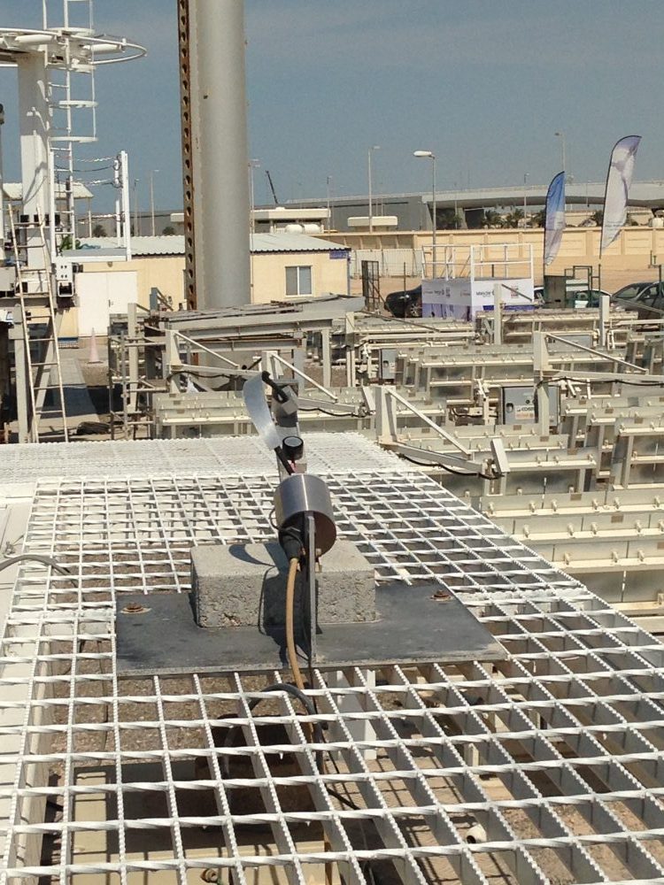 Fig 2.1: From top: Pyrgeometer measures effective sky temperature, SkyCam (black box) produces cloud mask images, PSP pyranometer measures diffuse irradiation, CHP1 pyrheliometer measures DNI. The first three instruments are shaded from direct sun by the black shading balls (left) articulated by azimuth and zenith angle motors operating within the central box. These motions also keep the Pyrhliometer pointed directly at the sun.
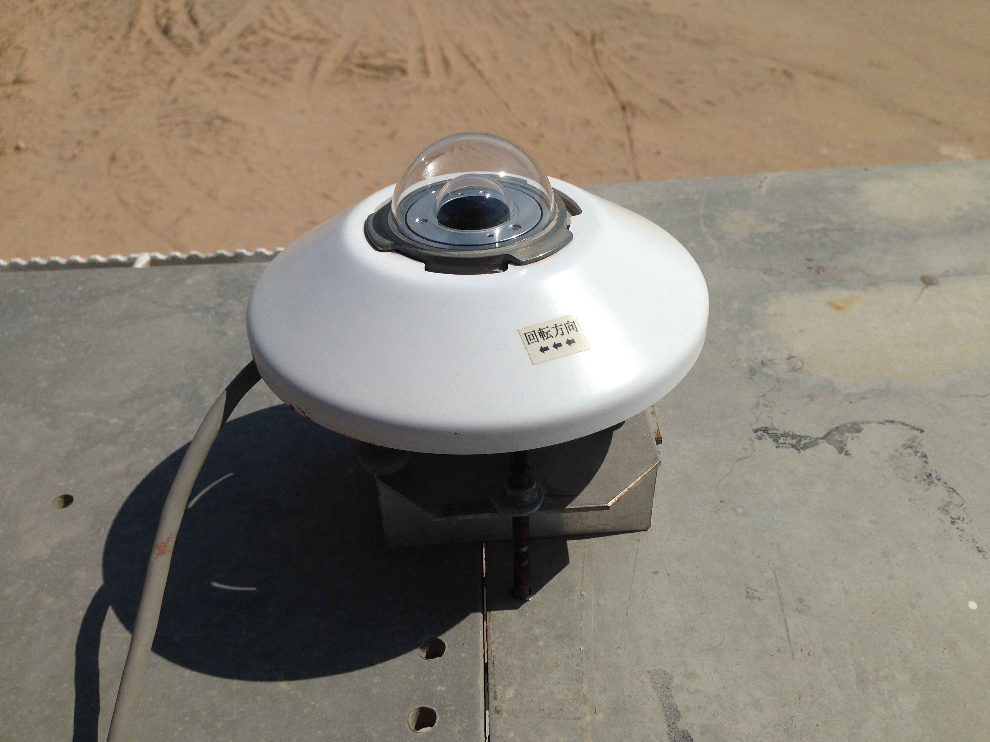 Fig 2.2: EKO Pyranometer at the Solar Irradiance Monitoring Platform (SIMP)
The MIEMP operates two Sun Photometers (a Cimel CE318 and a Cimel CE318-T Sun Sky Lunar Multispectral Photometer) as part of the NASA AERONET network:
https://aeronet.gsfc.nasa.gov/new_web/photo_db_v3/Masdar_Institute.html.
The AERONET (AErosol RObotic NETwork) program is a federation of ground-based remote sensing aerosol networks established by NASA and PHOTONS (PHOtométrie pour le Traitement Opérationnel de Normalisation Satellitaire; Univ. of Lille 1, CNES, and CNRS-INSU) and is expanded by networks and collaborators from national agencies, institutes, universities, individual scientists, and partners.
Sun photometers are high-precision light meters measuring the amount of sunlight arriving directly from the sun over a narrow range of colors or wavelengths. They are used to measure the extent to which aerosols and water prevent the direct transmission of sunlight of a specific wavelength through the atmosphere.
Through its international network of sun photometers, the AERONET collaboration provides globally distributed observations of spectral aerosol optical depth, inversion products, and precipitable water in diverse aerosol regimes.
The MIEMP CE318-T, a next generation sun photometer, capable of estimating spectral aerosol optical depths under moonlight, has been in operation since March 2020. The CE318 sun photometer, operational since June 2012, was upgraded to CE318-T functionality in 2020.
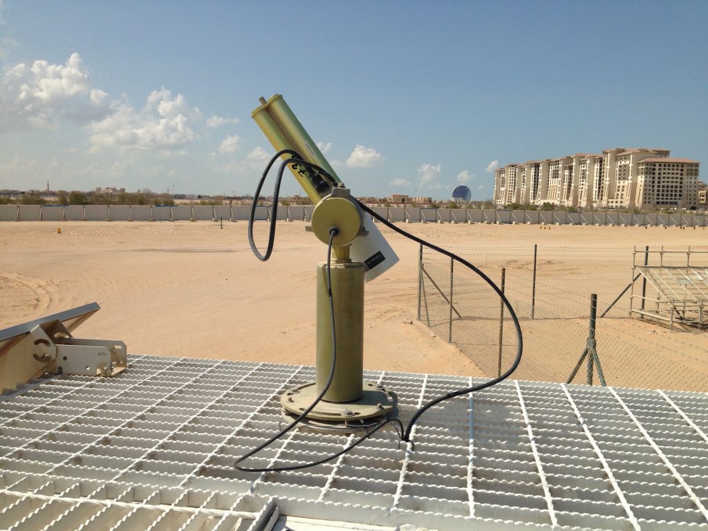
Fig 3: NASA AERONET Sun Photometer Cimel CE318, recently upgraded to CE318-T.
The Vaisala CL31 Ceilometer, is a commercial atmospheric LiDAR used to determine the height of cloud base, measure aerosol backscattering within the atmosphere, and investigate the structure of the Atmospheric Boundary Layer (ABL).
The CL31 uses a pulsed diode laser LiDAR technology, where laser pulses that are short and powerful are sent out in a vertical direction. The laser pulses that travel through the sky from the transmitter are then measured as the light is reflected (backscattered) by cloud droplets and ice, water vapor, aerosols and dust. The sum of the backscattering by all scatterers, like water vapor and aerosols, in the measurement volume are measured by the lidar.
The ceilometer measures the atmospheric backscattering profile every 16 seconds up to an altitude of 7 km and with a spatial resolution of 10 m. The backscattering profile can be inverted to obtain the atmospheric extinction profile.
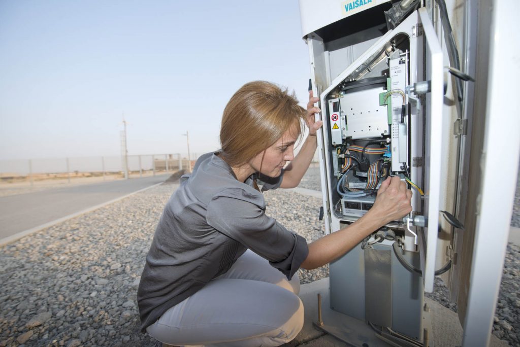
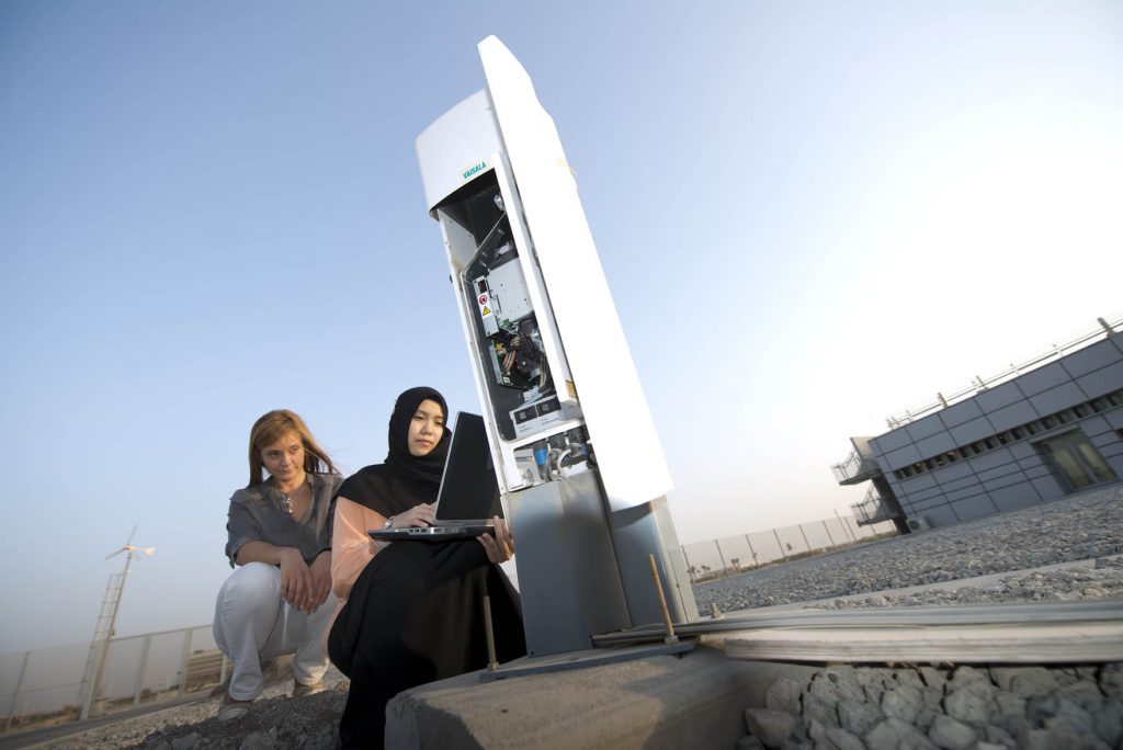
Fig 4: Vaisala CL31 Ceilometer (left) and 10-meter weather mast (right).
The Vaisala LT31 Transmissometer, is operational at Masdar Field Station since November 2019 and provides high accuracy measurements of ground-level visibility with a temporal resolution of 10 seconds. Visibility indicates the distance to which human visual perception is limited by atmospheric conditions. Transmissometers are instruments which derive visibility by measuring the light transmittance of the atmosphere.
The LT31 incorporates a white LED as a light source. White light is needed for the best accuracy in transmittance measurement.
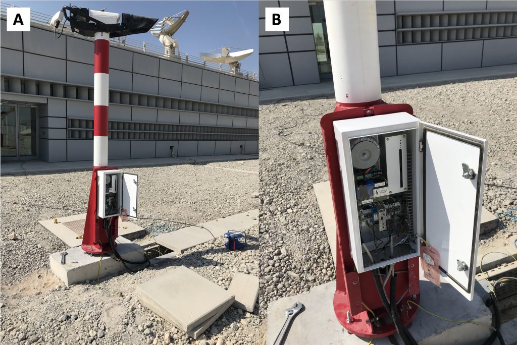
Fig 5: Vaisala LT31 Transmissometer.
The SAM started to acquire data in January 2012 as part of the SAM network: http://www.visidyne.com/SAM/SAM_DATA_MAS.htm. SAM is a precision solar tracking instrument that utilizes multiple cameras and a spectrometer to simultaneously measure the solar aureole caused by forward scattering and the optical depth of clouds. It is a ground-based instrument for the remote measurement of cloud and aerosol optical properties. It makes precise measurements of the radiance profile of the solar disk and aureole.
In operation since 2010, the MIFS 10-meter mast hosts a standard instrument suite (temperature, humidity (T,RH), barometer, wind speed and direction) as well as a 3-axis anemometer used in turbulence and flux studies.
One of two masts deployed in 2009, the Masdar City mast has been operated by Masdar Institute since 2010 to continue long term monitoring of weather patterns affecting land surface temperatures, wind energy resource, and boundary layer phenomena. The facility was refurbished in May 2016 with new Thies-KLIMA “First Class” 3-cup anemometers and new type-T temperature sensors at 20, 30, 50 and 50m to acquire vertical temperature profiles in support of Urban Heat Island research and Wind Energy assessment. The nearby Rotating Shadow-band Irradiometer (RSI) station also records wind at 10m.
The ZephIR 300 is a Doppler Lidar for wind profiling applications. It provides remote wind profiling across 10 user-defined heights from 10 meters (33 feet) to 200 meters (656 feet), allowing at the same time for extreme operation (from -40 C to +50 C).
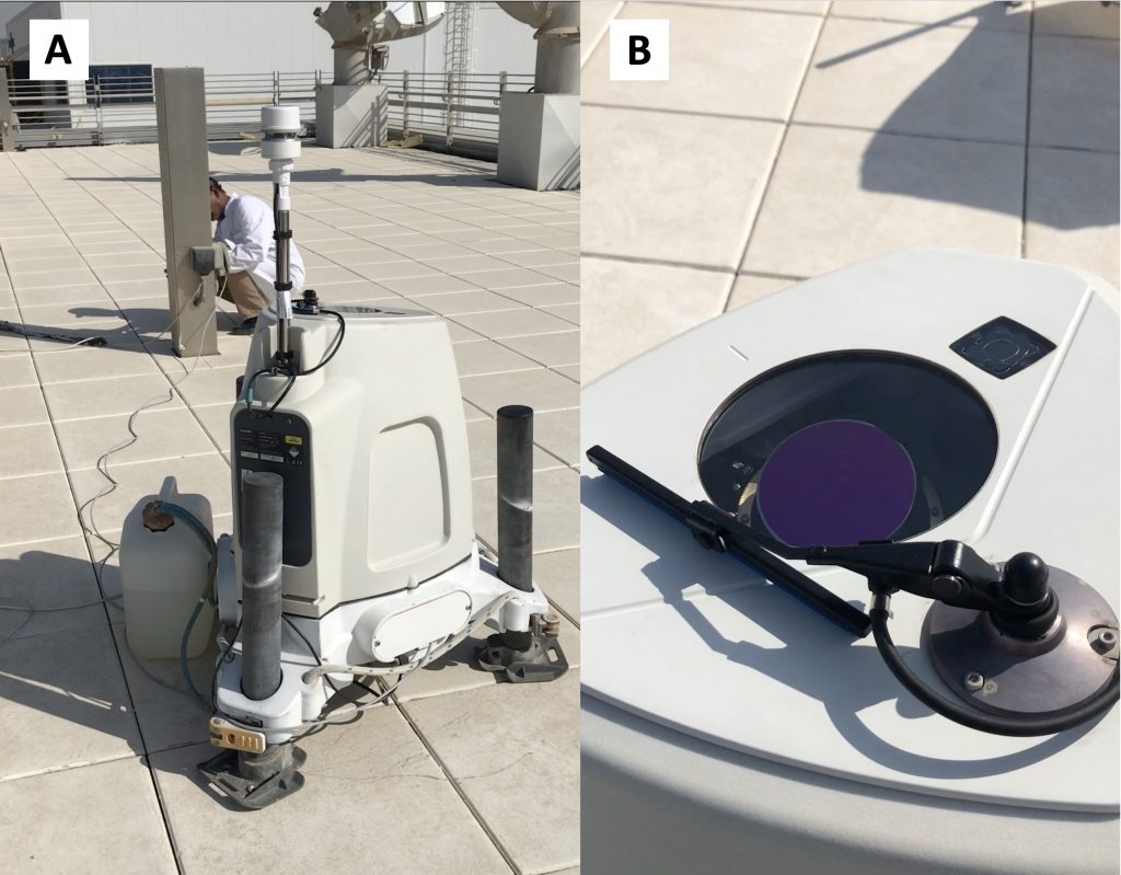
Fig 6: The ZephIR 300 wind profiler
Mangroves are the only forest able to grow in hyper arid regions like the UAE. Their ability to tolerate salt and endure extremely harsh and arid environments has been extensively investigated in the literature – both from the structural and functional point of view. However, the pathways through which different environmental conditions control water and carbon fluxes through mangroves still remain largely unexplored.
The main purpose of the Eastern Mangroves Eddy covariance station is to understand and model the ecohydrology and carbon assimilation patterns of Mangroves (and halophytes in general) in hyper-arid environments, where vegetation is subject to extreme temperatures and salinity.
The station measures the exchange of CO2 and water between the Mangrove canopy and the atmosphere (CO2 and water fluxes) through the Eddy covariance method with a temporal resolution of 10 Hz. These fluxes are proportional to the capacity of vegetation to fix carbon and can be used to model and parametrize Vegetation-Climate Interactions (V-Cis) in the land-atmosphere modules of Earth System Models.
The Eastern Mangroves Eddy covariance station acquires high-resolution (10 Hz) measurements of water vapor and CO2 atmospheric concentration, wind components (u,v,w) and air temperature above the canopy, and 5-minutes resolution data of Net Radiation, Temperature, Relative Humidity, Precipitation, Soil Temperature, and Soil Heat flux, plus a number of ancillary measurements like water level, and water salinity.
It is part of the European Fluxes Database Cluster (http://www.europe-fluxdata.eu/home/sites-list), and is presently under refurbishing to incorporate measurements of sap-flow (water flow across mangrove Xylem), canopy temperature and high accuracy water level in the framework of the international project “Exploring halophyte hydrodynamics and the role of vegetation traits on ecosystem response to disturbance at the terrestrial-aquatic interface”.
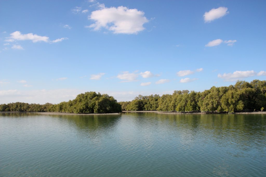
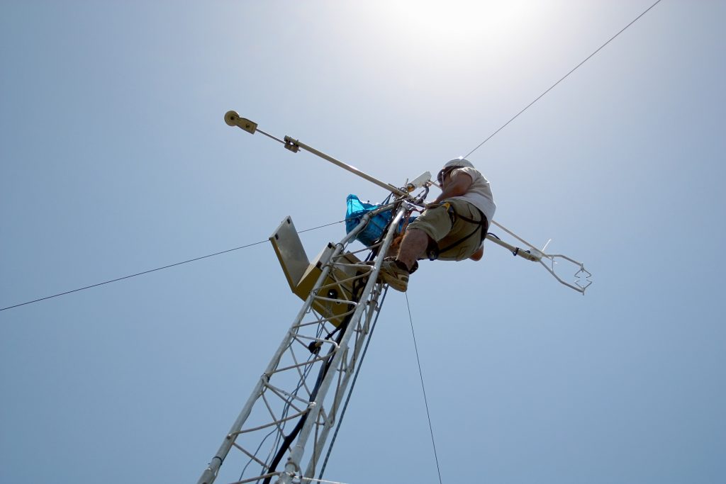

Fig 7: Eastern Mangroves Eddy-Covariance Station
Twenty-five urban heat island monitoring stations were operated from May 2017 through April 2019 downtown Abu Dhabi. Each station monitored GHI, RH, and wind speed, dry-bulb temperature at 3, 4, 5.5, 7 and 8.5m above grade. Data was sampled every 30 seconds and 5-minute averages were logged.
The sensor nodes were designed for the assessment of the Urban Heat Island (UHI) effect in Abu Dhabi. At the core of each node there is a Raspberry Pi single board computer. Different sensors were interfaced to this board to measure a number of diverse weather variables such as air temperature (at different heights), humidity, wind, land and façade surface temperatures, solar and irradiance. Collected data were uploaded to an Amazon Server the next day using the 3G cellular network. The status of various sensors and the sensor node itself was monitored through different diagnostic variables.
Each node included the following sensors/observations:
The wind tower is the tallest structure in Masdar City. A standard CSI weather station, with addition of a nephelometer (dust sensor) was deployed in 2010 to control wind-tower wind-driven cooling functions. These measurements, because of the Wind Tower’s high elevation, are least affected by construction of new buildings and landscape changes that are unavoidable in the growing urban environment of Masdar City. The remote location of the 50m wind mast provides a second location that has been relatively unaffected by development as of 2020.
The urban temperature and relative humidity within Masdar City is monitored through a network of 72 micro-loggers (Onset U12), installed at four heights: 3, 7, 11, and 15 meters above street level. Micro-loggers are simple and easy to setup and install loggers. These devices measured dry-bulb temperature and relative humidity at any programmed sampling rate—in this case, every 15 minutes.
Khalifa University operates one of seven rotating shadowband irradiometer (RSI) stations deployed by Masdar Power between 2007 and 2009 to assess the concentrating solar power (CSP) potential of the UAE. A second RSI station is operated periodically for comparison at the SIMP. These instruments monitor air temperature (T), Relative Humidity (RH) and wind at 10 meters in addition to their primary function of measuring direct normal irradiation (DNI) and diffuse horizontal irradiation (DHI). The relations between these DNI/DHI measurements and those of the SIMPs first-class instruments are of particular interest.
The RPG-HATPRO (G5 series) is a ground-based passive microwave radiometer, which operates in two frequency bands. It has seven channels in the K-band (22.24–31.40 GHz), for retrieving water vapor profiles, and seven channels in the V-band (51.26–58 GHz; oxygen band), for retrieving temperature profiles. The RPG-HATPRO measures brightness temperatures at a temporal resolution of up to 1 s. It has two operation modes: zenith pointing (Z-mode) and elevation scanning mode (S-mode). In the Z-mode, the Microwave radiometer points vertically, while in the S-mode it scans the atmosphere under elevation angles between about 4o and 90o.
The radiometer is designed to acquire continuous profiles of temperature and humidity across the atmosphere.

Fig 7: Microwave Radiometer
Dust profilers provide continuous measurements of atmospheric particulate with an aerodynamic diameter of 10 micrometers (PM10), less then less than 2.5 micrometers (PM2.5), less than 1 micrometer (PM1, ultrafine particles), and total suspended particles (TSP). These measurements can be used in different applications including air quality studies, radiative transfer modeling and solar resources assessment.
Three Dust Profilers with the following specifications operate at different locations within the perimeter of Masdar City:
The Masdar Institute Surface Particulate Matter Network (SPARTAη, https://www.spartan-network.org/abu-dhabi-uae) station measures fine particulate concentrations to evaluate and enhance satellite remote sensing estimates of PM2.5.
The SPARTAη Network (https://www.spartan-network.org) has been established to address the current gaps in knowledge of global PM2.5 concentrations. It provides publicly available data on PM2.5 mass, chemical composition, and optical characteristics for connection with satellite remote sensing and for air quality management.
The MI Alert Network Information System relies on the Masdar Institute Beam Down Radio Frequency Internet link and the Masdar Institute Campbell Scientific Data Logger Network, to transmit data from most of the stations and instruments (Temperature, Relative Humidity, Direct Normal and Diffuse Horizontal Irradiances, Wind at 2, 10, 20, 30, 40 and 50m, barometric pressure, dust level) described above to a central repository. SAM sun and aureole images are archived on a growing (n=6 as of March 2020) repository of 8-TB drives. Sun Photometer data is transmitted to NASA where it is made available along with data from 400 other Aeronet sites to all aerosol and climate scientists. SPARTAN data and sampling filters are transmitted to Dalhousie University where is archived with data from ten other SPARTAN sites around the world and made available to international collaborators.